

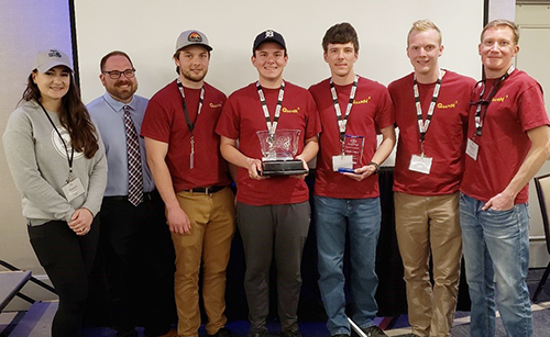
From left to right: Stacey Fenn, NSPS Young Surveyors Network from Michigan; Ferris
State University's Cory Smith, an adjunct instructor in Surveying Engineering and
the team coach; and FSU students Daniel Martin, Zachary Bemben, Nickolas Belka, Joshua
Sanders and Taylor Vandyke.
A team of five Ferris State University Surveying Engineering students earned a first-place finish in a 25-team field at the 22nd National Society of Professional Surveyors Student Competition for the second consecutive year.
The NSPS 2023 competition, requiring four tasks to complete, took place in Arlington, Virginia, in the Washington D.C. area, March 29-30, in conjunction with the spring meeting of the National Society of Professional Surveyors.
The top-finishing Ferris student group featured Nick Belka, of Hopkins; Zack Bemben, of Grand Rapids; Dan Martin, of Gladstone; Josh Sanders, of Cloquet, Minnesota; and Taylor Vandyke, of Cedar Springs.
On day one of the competition, students located existing survey control monuments in Washington D.C. The Young Surveyors Network identified monuments with points awarded for different survey options. Participants received general monument locations to start. Ferris’ team, and its competitors, rented bikes. NSPS also provided team members Metro passes. Teams could not receive rides driving to the sites and were required to remain together during and after finding the monument to take a photo as a record.
On day two, the team completed its remaining three tasks. The first was a triangulation survey, where one control point was the top of the Washington Monument. Students measured its angles using a Wild T-2 theodolite that predated more modern electronic surveying tools. While undertaking this survey, the students saw a monument near the Washington Monument in a utility hole. It is a 12-foot miniature copy of the Washington Monument used for surveys on the Mall. The next task was a leveling project for students to use a three-wire leveling technique. Leveling is establishing elevations at points on the Earth’s surface. Students received grades for survey accuracy and note forms. The last task was running a short traverse using a chain and a compass. Surveyors use this technology to survey a lot of Michigan’s public land. Students computed the position of the four points in the traverse to check the survey’s accuracy.
Click Surveying Engineering for more information about this College of Engineering Technology academic program.