

April 23, 2026
Will AI replace human land surveyors?
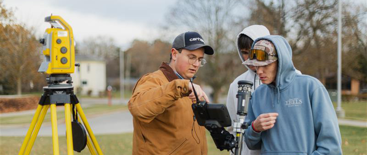
You may have noticed someone standing near a roadway with a tripod-mounted instrument and asked yourself what they’re up to. In many cases, they are land surveyors. These professionals measure distances, angles, and elevations to map and represent the Earth’s surface. Their work produces detailed records that serve as essential information for the planning, design, and construction of infrastructure, as well as determining property boundaries.
Assistant Professor Michael Flowers explained, “Surveyors make maps that include conditions as they exist, whether that’s going out to make a map of an empty lot so that it can be developed, or making a map of an existing bridge so they can repair and rebuild the bridge.”
What Tools do Survey Engineers use?
Surveyors rely on many different instruments to complete their work, ranging from simple tape measures to advanced drones. Some common tools include:
- LiDAR Scanners: Instruments that use lasers to collect 3D coordinates at a rate of a million points a second
- Drones: Aircrafts equipped with LiDAR scanners or cameras
- Global Position System (GPS): A high-precision way to map 3D points of the physical world
- Robotic Total Stations: Instruments that measure distances and angles to establish 3D coordinates on objects
How has AI Transformed Surveying Engineering?
Technological advancements over the last couple of decades have allowed surveyors to collect more data much faster. Even though AI helps with this process, surveyors still need to review and identify data for the client.
As Flowers asserted, “Traditionally, collecting data points has been done manually. Surveyors completed this in the field or at a computer, identifying features one point at a time.” AI is making the process automatic and quick, so surveyors need less and less manual extraction.
While AI is streamlining survey tasks, this is simply one more technological advancement that surveyors have experienced in the last few decades. A surveyor still needs to complete key tasks and likely will need to for years to come.
Why Human Surveyors Are Needed
1. Physical Presence is Needed
Survey engineering includes a large amount of hands-on, fieldwork. For instance, when determining a property line, surveyors must dig to locate buried monuments that define boundaries. They also set stakes in the ground to guide construction workers on where to build sidewalks, foundations, and utilities.
While LiDAR technology is a powerful tool, it comes with practical constraints. Even when a site is scanned, survey engineers must set ground control points to ensure accurate data.
For example, snow can distort elevation readings and produce incorrect coordinates because surveyors cannot treat it as true ground. Similarly, drone-mounted cameras may struggle to record accurate measurements beneath dense tree canopies.
These challenges highlight why the physical presence of a surveyor will likely remain essential.
2. Discernment
AI needs to be treated as a tool, not a replacement for human effort, as it lacks the skill to handle real-world problems with consistent accuracy. Since field sites are dynamic and unpredictable, professional judgment remains essential. A surveyor must navigate sites and accurately stake them, so builders can reliably use these measurements.
Additionally, determining a boundary location can be a complex process. It often requires interpreting ambiguous documents and conflicting field evidence.
Flowers stated, “Knowing when you have done your due diligence is always changing. It’s sometimes difficult for surveyors to discern when they’ve put in the appropriate amount of effort to complete a project.”
3. Legality
Regulations often require a licensed surveyor to review and approve a survey before a project can move forward. This oversight is a critical safeguard that ensures trust and accuracy in every project.
Surveyors also play a vital role in protecting property rights, carefully interpreting deeds and legal descriptions. This helps prevent disputes as surveyors legally liable for ensuring that boundary lines are measured according to the standard of care.
AI Will Not Replace Human Surveyors
Although AI has helped advance survey engineering, it cannot fully replace the profession.
Surveying still requires people on site to operate instruments and set markers or other tangible references. Human judgment remains vital because drawings and plans do not always align with actual ground conditions. Surveyors must respond in real time to what they observe and adjust decisions accordingly.
Their responsibilities are also reflected in laws and regulations. Accurate interpretation of records and plans is essential, since these documents often form the foundation for construction projects and property boundaries.
A Career in Surveying Engineering
The Surveying Engineering bachelor’s degree program at Ferris State gives you strong technical skills and practical field experience to prepare you for a rewarding career in a high-demand field. Common career paths include:
- Licensed Surveyor
- Surveying and Mapping Technicians
- Cartographers
- Geographic Information Systems Technologists
The program meets educational requirements to become a professional surveyor or a professional engineer.